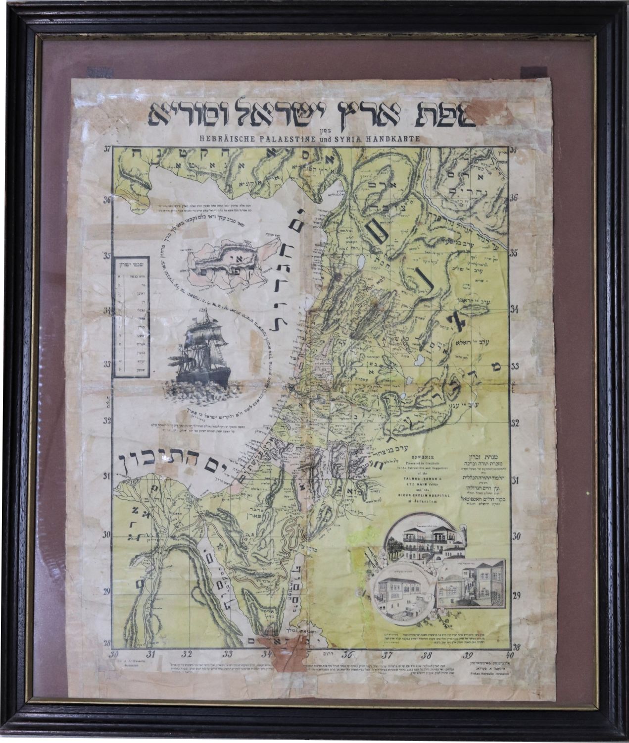
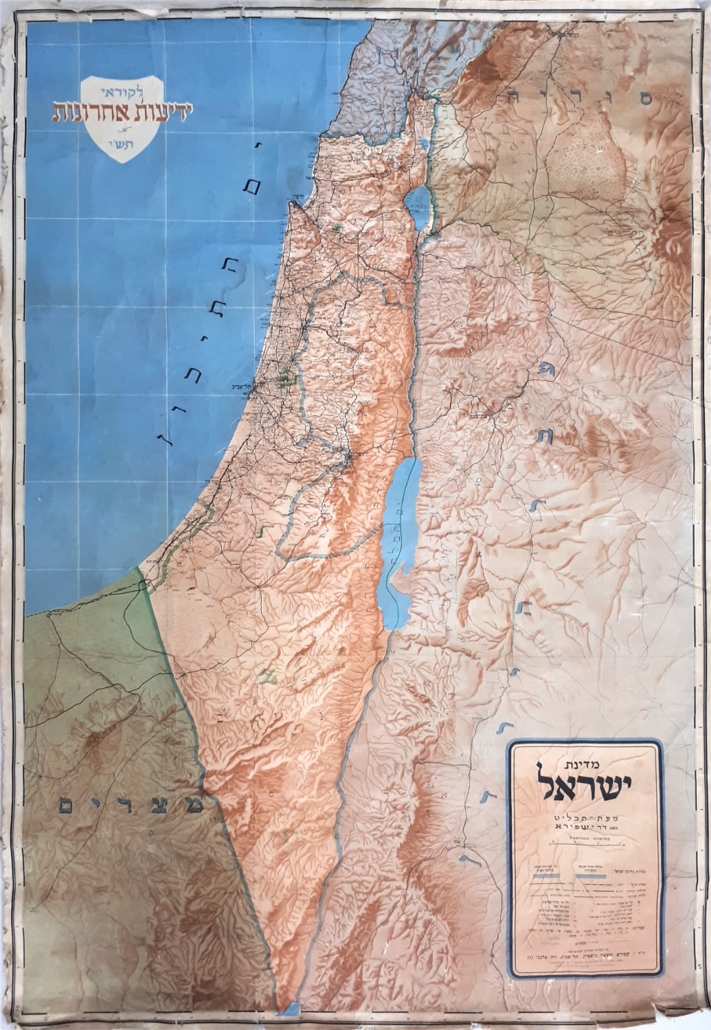
Map of the Land of Israel and Syria with the division of the tribal lands - known as the "Pinchas Horowitz Map", the Etz Chaim Yeshiva and the Bikur Cholim Hospital, a large color lithograph designed by Pinchas Horowitz. Monsohn Printing Press 1903. The first map in a series of maps printed in Monsohn in the following years.
'Minchat Zichron', a memorial of thanks and blessing from the Talmud Torah HaKlalit and Yeshivat Etz Chaim and the Bikur Cholim Hospital in the Jerusalem". Map of the Land of Israel and the East Jordan with illustrations of Bikur Cholim Hospital and Talmud Torah Etz Chaim buildings. Ships sailing in the Mediterranean to the Land of Israel and the verse from Isaiah 9: "שאי סביב עיניך וראי כולם נקבצו באו לך...". This map is one of the first attempts in Jerusalem to print a Hebrew written map on a semi-scientific basis with a cartographic marking method known as "larval ridges". [See: Yehoshua ben Aryeh, Eretz Yisrael in the 19th Century, Rediscovery. Carta Publishing and the Society for the Investigations of Eretz Yisrael and its Antiquities, 1970. Page 89]. The map mentions some Hebrew colonies founded as part of the first aliyah.
The map before us is signed in print by the editor Pinchas Horowitz Jerusalem. Palestine scholar Pinchas Halevi (son of Mordechai Isaac) Ish Horowitz, lived in Tiberias and immigrated to Jerusalem with his wife Esther and children in 1895. After arriving in Jerusalem, he was one of the associates of Rabbi Shmuel Salant, one of the greatest rabbis of the old settlement in Jerusalem. In the middle of the 19th century, Rabbi Shmuel Salant founded the large "Etz Chaim" yeshiva, and was one of the founders of Bikur Cholim Hospital. The difficult economic situation obliged Rabbi Salant to initiate various fundraising activities among the Jews in the Diaspora. One of these actions resulted in the connection between Phinehas Horowitz and Rabbi Salant. Rabbi Horowitz was already known as a researcher of the Land of Israel, in possession of a map of Hebrew names of places in the Land of Israel that were collected from various sources, and with the help of foreign maps, the lithography and printing of Monsohn in Jerusalem, in 1903 he produced the 'Map of the Land of Israel and Syria' in Hebrew language. In 1908 he published another edition of the same map. (Phinehas Halevi died in Jerusalem in 1939).
Laor Collection: Pal 161.1
Map: 60x46 cm. Wooden frame: 70x60 cm. Reinforcements with adhesive paper, missing tear at the top right without damaging the body of the map, missing tear at the bottom with slight damage to the edges of the map. Folding marks. Glued to a hard substrate for display and storage, and framed. moderate condition.

