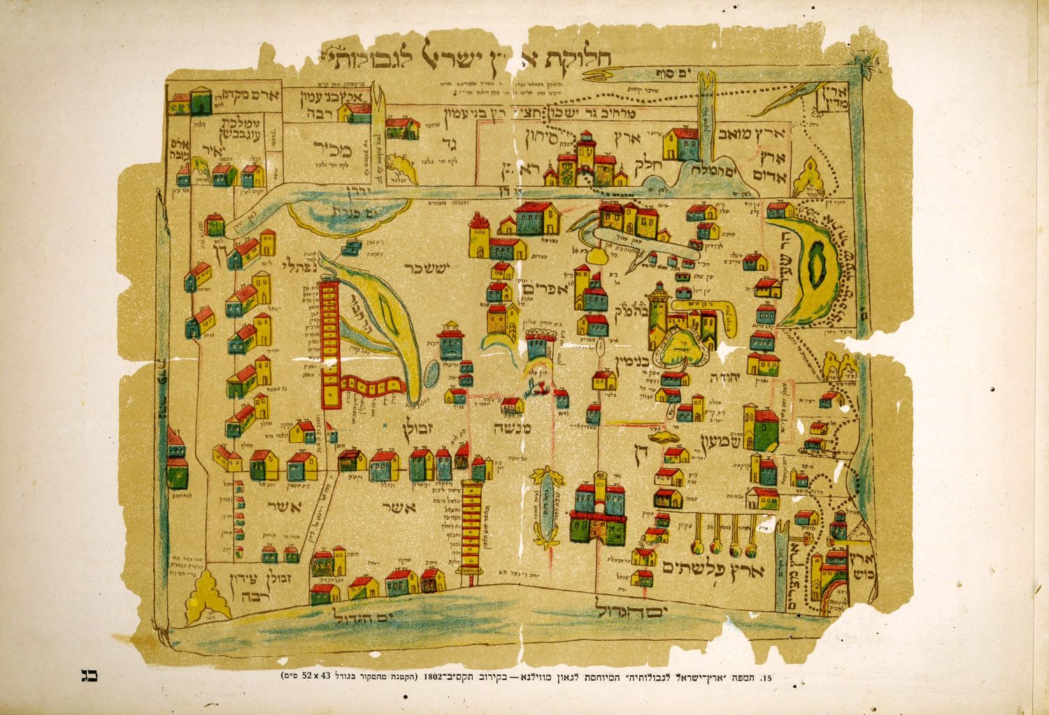
Map of Eretz Israel according to the division of the tribes by the cartographer Bon Rigobert [1727-1794] - hand-painted etching, Paris c- 1762. Jean, publisher Lattré.
On the right is a handsome karatush in the form of Aharon HaCohen, the Menorah, and the Ark of the Covenant, alongside an angel Poti playing the harp. Behind trees that hint at the exotic landscape of the Land of Israel. The tribal lands were painted manually, each farm a different color.
From Atlas moderne ... par plusieurs auteurs. Paris, Latr, [1762-83].
Bonne from the most important cartographers of the end of the 18th century. At the beginning he produced charts for the publication of the sea atlas. His most famous maps were published in the Moderne Atlas in 1772. Where the map before us was also published.
Laor: 120. The Israel Museum: The Norman Bier Section for Maps of the Holy Land. Record No. B95.0647
Map size: 31x44 cm, page size: 37x51 cm. Folding mark along the map. Minor tears to margins. Good condition